Tim Wilkinson
Spatial Analyst

Responsible for geospatial data processing and programming; including Remote Sensing (RS) for Vegetation Mapping, spatial analysis for conservation assessments and automating the ingestion of geospatial data. Specialist interest is in open source geospatial development.
Geospatial Conservation Assessment Tool (GeoCAT) and Conservation Assessment Tools (CAT’s)
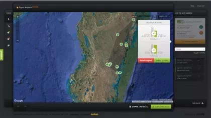
With the huge number of species in the world (recent estimates put this at 8.7 million of which 360,000 are plants), we face a colossal task in cataloguing and assessing the conservation importance of these species. One of my roles is to streamline this assessment process by applying the power of computers and the internet to the problem through two tools, a GIS based CATS (Conservation Assessment Tools) capable of processing multiple species records and GeoCAT an online version of CATS. My current focus is to transition and develop the now redundant ArcView CATS tools into an ArcGIS environment. In parallel we have a web interface to these conservation tools - GeoCAT. This uses Google Maps, where users can quickly and easily combine data from many sources (GBIF, Flickr, INaturalist, etc.) as well as the users own data. Analysis is done with one button and is visualised instantly, providing an indication of the conservation status of the species.
- BSc King’s College London
- MSc University College London
Moat, J., Williams, J., Baena, S., Wilkinson, T., Demissew, S., Challa, Z.K., Gole, T.W. & Davis, A.P. (2017)
Coffee Farming and Climate Change in Ethiopia: Impacts, Forecasts, Resilience and Opportunities. Summary Report 2017.
The Strategic Climate Institutions Programme (SCIP). Royal Botanic Gardens, Kew (UK). Pp. 37
Moat, J., Williams, J., Baena, S., Wilkinson, T., Gole, T.W., Challa, Z.K., Demissew, S., & Davis, A.P. (2017)
Resilience potential of the Ethiopian coffee sector under climate change.
Nature Plants 3: 17081 (2017).

