12 April 2018
On the quest to discover and protect Mozambique’s unique plant diversity
Google Earth has launched a virtual exploration of Kew’s Tropical Important Plant Areas. In this blog post, Kew botanist Iain Darbyshire describes how satellite technology is helping to discover and conserve the most important sites for plants in Mozambique.

Discovering important plant areas
For over a decade, Kew and our partners in Mozambique – principally the Instituto de Investigação Agrária de Moçambique – have been studying the plant diversity of this biologically rich and exciting country. Some of the sites we have explored are well known to scientists – for example the Chimanimani Mountains, which are home to 74 plant species found nowhere else on earth. Other areas have even achieved wider fame, such as Mt Mabu – the ‘Google Forest’ – where studying Google Earth imagery led to the discovery of the largest expanse of mid-altitude rainforest in southern tropical Africa.
But most of the important sites for plants in Mozambique are scarcely known, even within the scientific community. With severe threats to many of these sites and their species, time is running out to get them on the conservation map.
Kew and our partners are tackling this problem through mounting a series of expeditions to poorly studied sites, as part of our Tropical Important Plant Areas (TIPAs) programme – aimed at identifying the most diverse and unique sites for plants, and those that are the highest priorities for protection. In October 2017 we launched the first of these expeditions, focussing on the Ribaue Mountains of northern Mozambique.


Planning an expedition – targeting species and sites
Planning for such an expedition starts with gleaning whatever fragments of information are available to identify the unique and rare species and habitats that occur at the target site. For Ribaue, we produced a makeshift field guide with photos and locality information for our 30 top-target species – invaluable in helping us to focus our efforts during our ten days in the field.
Easy access to satellite imagery has revolutionised the way we now plan and conduct expeditions. Nowadays we download Google Earth imagery onto smartphones to easily navigate around an area and reach the most interesting looking plants or habitats. Of course, this doesn’t always go to plan – what looks like a gentle stroll on Google Earth can prove to be a vertical climb or many hours spent thrashing through dense thicket!

Exciting botanical finds
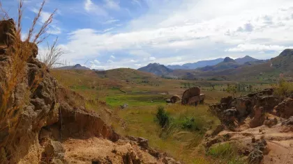
The Ribaue Mountains tower above the town of the same name. A series of huge granite domes with patches of lush forest and woodland in the gulleys and gentler slopes.
The rock outcrops are botanical treasure troves, with impressively large stands of cycads, aloes and succulent euphorbias. Despite our expedition coinciding with the end of the dry season, we managed to find a wide range of interesting plants in the bone-dry rock crevices. We discovered a large population of Plectranthus cucullatus, a species in the mint family unique to these mountains that was described by Kew botanist Alan Paton in 2013. Just a stone’s throw away, we found a tiny pink-flowered orchid that we later discovered was new to science.
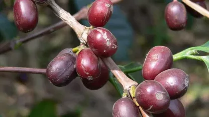
Walking down from the rocky slopes, we found the forests to be just as full of botanically interesting and rare plants. Among our finds, we rediscovered a relative of coffee that is yet to be formally named. As the expedition progressed, we continued to make exciting finds and collected 270 dried plant specimens - used to identify and document the plant diversity of the area. The satellite imagery proved to be invaluable, allowing us to cover as much ground and as many habitats as possible in the short time we had available.


A race against time – threats to Mozambique’s plant diversity
Much of our knowledge of these little-known sites comes from plant specimens collected by botanical explorers over many decades, and with the world in such a rapid state of change there is no guarantee that we will still find a species or its habitat at a historical location. One of the main aims of these expeditions, therefore, is to assess the current state of these sites and the threats to the key species and their habitats. This can sometimes be a sobering task. The threats at Ribaue were all too evident from the outset – we saw large areas of forest and woodland being burned and cleared to make way for smallholder farming. Not far from our campsite we came across several majestic 30m tall Newtonia buchananii trees ablaze. Once left fallow, the cleared and burned areas are quickly invaded by a rampant South American shrub – Vernonanthura polyanthes – which prevents regeneration of the native trees. This invasive species has only recently reached Mozambique and was first recorded in an area nearly 800km to the southwest, so it is an unwelcome surprise to find it at Ribaue. With all these threats, it does feel like a race against time to save the unique plants of this site.
But there is still hope. By highlighting the incredible biodiversity of sites like Ribaue, together with the services the plants provide for the local communities such as natural foods, fibres and protection of soils and water resources, we can present a persuasive argument for their protection.


Now you can discover for yourself the same areas that scientists at Kew have studied and explored using an interactive story package from Google Earth.
This exciting story 'Reducing Plant Extinction', highlights Kew’s Tropical Important Plant Areas programme, and explores some of the unique landscapes where our scientists work.
Acknowledgments
This work is only possible because of the kind support of the Jonathan and Jennifer Oppenheimer Foundation, Stephen and Margaret Lansdown, together with the Bentham Moxon Trust.


